Showing posts with label san francisco weather. Show all posts

Wednesday, March 12, 2014

Dueling Weather

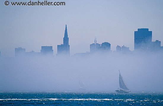
Sunlight on the Bay, Fog on the City.

Dusk on the Bay with two marine layers off the coast.

Saturday, March 08, 2014

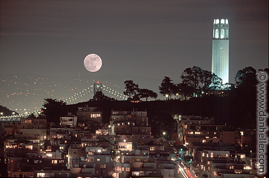
Moody Shadows & Fog

Evening has come to pass The time of day doesn't last Evening has earned its place today

Cold hearted orb that rules the night Removes the colours from our sight Red is gray and yellow white but we decide which is right And which is an illusion


Pinprick holes in a colorless sky Let insipid figures of light pass by The might light of ten thousand suns Challenges infinity and is soon gone Night time, to some a brief interlude To others the fear of solitude


-lyrics Moody Blues

Monday, February 24, 2014

Thursday, February 20, 2014

Alcatraz - A Foggy View

Most of the commercial shots you see of Alcatraz are from the San Francisco side of the Bay where you view the infamous prison island out in the middle of the Bay. From my perspective Alcatraz looks to be close to the Golden Gate Bridge, in fact, there are a couple of miles of open water between the island and the bridge.

History books often talk about the 'torture' of seeing and even hearing the sights and sounds of San Francisco from the prison.

Imagine further, the prison completely buried in the fog.


Sunday, February 16, 2014

Golden Gate in Fog

The Golden Gate Bridge is nearly ten miles from my window. The zoom lens brings it closer and the fog takes it mysteriously away.


Bigger, clearer, closer views - click here

Tuesday, February 11, 2014

A Louring Sky

louring - to be overcast, dark, menacing


louring - to look angry, sullen or threatening

louring - a menacing scowl or appearance

Friday, February 07, 2014

Finally Fog!

And with the fog - some rain our drought plagued hills and dales, figs and grapes need.


We'll get enough moisture to water local bushes and shrubs but not nearly what we need to fill the reservoirs.

The key to our year-round water supply is snowpack in the Sierras. Right now we are hovering around 15% of normal. Estimates are we would need snowfall every day through April to get back to full. In the meantime, rainy days are my favorite days - particularly this day.

Wednesday, January 29, 2014

Fog City


I regret that I am not adept enough to fully capture what I see with my eyes. One particularly fascinating phenomenon I get to witness is the fog rolling in from the Pacific. Whether it creeps through the Golden Gate or oozes over the hills of Marin or slowly swallows the city of San Francisco, I find the fog and marine layers provide some of the most compelling views out my window. With our late winter season just now arriving, this is my first attempt to deliver the Fog City views for you. Hopefully our drought conditions will moderate and I will have more chances to film the fog.


link to enlarged photos use scroll to review all


Thursday, January 02, 2014

Cough!

We're in the midst of our second week of 'Spare the Air' days here in the Bay area. This is unusual for us, generally strong ocean breezes scour the air but for a fortnight we have been breathing under a layer of particulates more often associated with L.A. skies.

This does lead to some interesting color swatches, what we used to call 'artificial coloring added' down south. Hopefully the onshore winds will come back soon and the winter rains will finally arrive.

2013 was a very dry year. Reservoirs are low, the snow pack is miniscule. Come on rain.

Friday, October 25, 2013

Winter Fog


The Farmer's Almanac predicts a wetter than normal winter here in  the Bay Area. This is good news, we've had a couple of dry ones of late and the reservoirs could use a topping off. A wet winter means more fog and unlike some I really enjoy the gray atmosphere.

The picture above is a morning shot from the Marin Headlands through the Golden Gate and back towards San Francisco, not exactly my perspective but a nice shot. I live just about eight miles left of those two bridge towers, sort of out through the upper left hand corner of the picture. Each evening this week from my perspective the sun is setting directly behind the Golden Gate Bridge. There are times when the view out my window is a complete distraction from my writing but I find it impossible to complain.

I like the gray weather in all it's shades of grey.

Friday, August 16, 2013

For the Landlord


From May until September the sunset from my lofty vantage point is over the North end of San Francisco Bay during our typical foggy summer. The peak just to the left of the setting sun above is Mt. Tamlapais for those not familiar with the Marin skyline.


I have made excuses in the past for not having adequate photography equipment but these fuzzy snapshots will placate the landlord who wants me to share the visual wealth of my aerie perch.

Sunday, June 05, 2011

Snowpack

I wrote a short post the other day about our late wet season this year. As some of you know I have this tendency to follow single facts down the rabbit hole that is the internet. I like research, I wrote my Ph.D. dissertation on the topic. Yes, the snowpack interested me, so I looked a bit deeper as it were.

Yesterday and today it was been wet and grey outside my windows and I read an article by a water management district representative who said that we should not be worried about flooding just yet because this "usually wet late season storm would keep the temperatures cold in the mountains." He went on to say that this system was also going to add even more snow to the already above average snowpack, so the flood watch would continue much later than usual, probably until the end of July.

Off I went looking for data on average snowpack and runoff. The first good source I found was a chart based on the average snowpack as of April 1st. It seems that is an excellent date to measure from because late March and early April is statistically the height of the snowpack throughout California. The melt begins around then followed by the streams and rivers beginning to rise.

First stat I found was that as of June 1st we were at 109% of the average April 1st snowpack up here in northern California. Not a worrisome total at all, but you gotta be careful with statistics. If we are at 109% of normal that would be one thing, but the numbers say we are at 109% of normal for April 1st that arbitrary measured date. So I had to ask: On June 1st, how are we compared to average for June 1st? I mean shouldn't we already have had about two months of melting?

It took some searching but I found the numbers. Before this big storm came through, the one I am looking at outside my window right now; before this drenching we were at 559% of normal snowpack for June 1st. No typo there - Over five times normal. Its a double whammy of a big snow season and a wet spring that has delayed the spring melt.

Donner Summit at the top of the pass between Sacramento and Reno has seen a staggering 740 inches of snow this winter/spring (so far). Only four years since 1900 have seen snowfall in excess of 700 inches. The average is just over 400 inches. In 1982-83, Donner got 880 inches of snow; that summer in many higher elevations the snowpack did not completely melt, not until the following spring after a more normal winter in 83-84.

What does this all mean for the 2011 fire season and for potential flooding? Well short term predictions are generally unpredictable. But as far as global warming or climate change as is the current PC label - this year's wet winter adds nearly nothing to that conversation. Annual or decade long variations do not preclude the scientific evidence on the long term effects of greenhouse gas emissions. The only piece of evidence I can verify is that it is very wet outside at that moment and snowing up in the Sierras.

Meanwhile, could someone please locate two wolverines and a pair of pythons.

Wednesday, June 01, 2011

Weather Below the Radar

Yes, this is a post about the weather.

No, the weather here in Northern California has not had the impact of the rains, floods and tornados of the rest of the country. But yes, strange and unsettled weather does seem to abound this year.

Today is June 1st, normally we would already be a full month into fire season. You see California has a wet and a dry season. Up here in the north, the rains comes from late October until April. Then everything dries out and we have fire season. Sometimes long fire seasons. Today as I look out my window, I see very little of the great view towards the City and Bay of San Francisco because it is raining. Checking the weather report, there is yet another much bigger storm coming our way this weekend. Our wet season is not even close to being over.

Yesterday I read that the waterfalls in Yosemite Park are spectacular this spring because of all the snow melt. We have had 20% and in some areas 40% above average snow pack this winter. This means great waterfalls, more water for the reservoirs and hopefully more for the Central Valley farms. And, if the view from my window is not a saturated mirage, we are not done. When these storm hit the the mountains, they will add still more to the snow pack.

Last summer most predictions were for below average rainfall totals this year. We are in the midst of an La Nina system out in the Pacific and that means less rain for us and floods in Australia and Indonesia. But massive storm systems out the the Gulf of Alaska have been funneling down our way all winter and the result is La Nina has been trumped by the wet weather from the Great North.

Although this all sounds benign and good for everyone, there is the matter of the fuel for fires when it eventually dries out. Wet weather encourages the growth of underbrush and grasses that are the basic fuels for wild fires, so when we finally get the big dry out; the potential will be there for some big fires as well. 

All in all, strange weather this year. Environmental conspiracy theorists may now take over the conversation.
ADDENDUM: I wrote too soon, today it was announced that a warm spell in June could cause massive flooding from the 2X even 3X higher than average snow pack. The sky is falling! The sky is falling!! And it appears the apocalypse is white and fluffy . . .

Thursday, November 04, 2010

48 to 68


The Green Sun comes to us courtesy of those very underfunded folks at NASA. For details on why green or why not yellow? I refer you to the website full of truly amazing images of yellow, red, blue and paisley suns plus other color enhanced celestial bodies. Today, however, I would like to discuss the one truly great unifying topic of conversationalists around the globe. No not religion, nor sex and at this time of year, definitely not politics. Today I shall dwell on the weather, in particular on not so extreme temperature varients.

The sun had once again asserted itself after a week of rainy grey. Not complaining mind you, I am terribly fond of grey and damp but the weather is as they say changeable. Mid-term predictions (isn't it nice to read 'mid-term' not followed by election), oops sorry politics .... anyway the weather forecast over the next 30 days here in Berkeley calls for temperatures not exceeding 68 degrees nor lower than 48 degrees. Over the previous 30 days the range has been 99 degrees for the high and 49 for the low. Completely unacceptable!

If I were given the power to control the ambient temperature with a twenty degree range, well then the next month is near perfection. Okay, I can go for 70/50 perhaps even 72/52 but that strains both the upper and the lower limits of personal heating perfection. If I get a thirty degree range then I would happily exist in a 71/41 world. One can always visit olde friends in the north for a white christmas once a decade. Skiers and other winter athletes can travel to snow and ice, but simple day to day existence should require no more than a light cotton hoodie and a couple of World Wildlife Fund throw blankets. If it gets really chilly at night, well then you just throw on another cat. Air conditioning should be limited to "places I might visit in winter" and everyone everywhere should be required to power all AC with solar energy.

Yes this was a bit of a restrained rant today, but I'm feeling much better now; how about you?

[11/14/10 Those bastards! 82 degrees today]

Thursday, October 21, 2010

One Last Weather Post

With the forecast steady for partly cloudy days and evening fog followed by weekend showers, I will make this the last lament about missed sun, moon and bridge observations.
The shot above is from last night just before sunset, framed in that dim pink swath just above the water is the Golden Gate Bridge, trust me. The shot below is from about fifteen minutes later the very faint line across the sun is one of the cables from the bridge. Yes to the naked eye and the binocular assisted view it was a very nice image.

Next post, I shall return to those thrilling days of yesteryear when I blather on about whatever comes to mind, heart, soul or spleen.

Oh and the moonrise was brilliant last night, I was out in North Berkeley and got a perfect view of the gibbous moon slipping in and out of the high clouds but that was far to the east, by the time the moon had swung across the sky to my windowed western view, twas nary a shimmer behind the grey.

Twilight Time, to dream awhile
In veils of deepening gloom
As fantasy strides over colourful skies
The fog disappearing from view
Moody Blues, Twilight
Days of Future Passed

Tuesday, June 15, 2010

Fog City


"The coldest winter I ever spent was a summer in San Francisco." 
- attributed to but never said by Mark Twain

I'm back to window gazing from my perch in the East Bay and now that summer is nearly upon us the infamous fogs of San Francisco are beginning to appear. Out my window I can get three different views of the grey shroud that is summer around the Bay. As I have mentioned previously, directly out my window about ten miles away is the Golden Gate. Yes, there is a bridge there now but long before the two towers of the span were erected the gap was known as the Golden Gate. It is the narrowing that separates the pacific ocean from San Francisco Bay. Through the gates can pour fog at a pace that literally fills the Bay. Now SF Bay is over 60 miles long and I can see over 50 miles of that length from my window. So the effect of the fog on the surface is never quite the same. How far will it creep today? How can it move so fast? And where might an cargo ship pop out of the fog?

Then to the immediate north of the Gate are Sausalito and the Marin headlands that rise up to 2500 feet at Mt. Tamalpais. When the fog comes up and over the headlands that means a big fog bank is rolling in from the north. Since the sun is setting way up to the north these days, the sunsets take on some interesting shades of pale. More of a sunglow than a sunset.

The south side of the Golden Gate is the City at the tip of the San Francisco Peninsula. There is a ridge that runs down the center of that big thumb of land. On the west side (the ocean side) are the Sunset and Richmond districts of the City. The temperature is always cooler out there, often 10-15 degrees cooler than downtown and as much as 20-30 cooler than over here in Berkeley. But from my vantage point the buildings of downtown San Francisco, Coit Tower and the Sutro Tower on Twin Peaks are what the creeping fog can slowly swallow when it creeps up & over the peninsula divide.

All this weather means a daily summer time viusal treat from mother nature. I wish you could see it. Come visit sometime.


Tuesday, May 25, 2010

Louring Sky


Most days when I write from the apartment I am able to lift my head from the monitor and see the magnificent view I have of the San Francisco Bay. Often times I lament that I do not have a camera capable of capturing the variety of evening solar displays that play out through my glass wall. I could fill this blog three or four nights a week with the end-of-the-day panorama.

But I am not a real sunny weather guy, I like cool and moist. I find storms of all kinds both fascinating to watch and energizing to experience. As I have said before, my view of the Golden Gate narrows into the Bay gives me lots of vantage points for storms both big and small. I like the greys and the fast moving clouds. One evening last week there was a two hour sunset without the sun. Bank after bank of clouds pushed across the horizon only slightly backlit by a well obscured sun. The low clouds made me remember the term lowering sky and I wondered why it was pronounced with a soft "O" as in Tao or Mao instead of a hard "O" as it would appear to be.

A quick bit of research found the original spelling -- louring sky and the source of the pronunciation even when the term used more often these days is lowering sky. Next, I went on an internet search for a picture of such a sky and was disappointed by the offerings. I was going to abandon this post when I look up and saw the sky in the picture above. There was a perfect louring sky for this post right outside my window.

As I finish this in the early afternoon, the rain has moved in, drizzle really; but another glorious grey day.

Saturday, April 10, 2010

From Above the Treetops

I know I promised my new view on the world would not dominate my posts, but sometimes....


First, there is the weather. While I still await a summer of San Francisco fog, which will dramatically alter my eighth floor view; I am already entranced by the drama of storms sweeping or creeping across the Bay. Sometimes a sea level disturbance will force its way through the narrows of the Golden Gate and burst into the open Bay; other times the grey will slowly make views and cities and bridges disappear as a western storm front advances. Today the weather is fickle. Right now the port of Oakland to the south is bathed in sunlight, while the Bay out to the Golden Gate is shrouded in a slush of rain and mist. San Francisco is a dark pop-up silhouette ducking in and out of the overcast.


Or would that be undercast? What I have noticed in my first few weeks up in my aerie is that a lot happens below me. Not only does much of the weather hug the ground but rain storms that fall past you have more character than those that simply fall on you. In addition, there are the birds.


The "average" treetop between my perch and the Bay is about thirty feet high. Here and there a grandmother tree reaches up to double that height and there are a few massive pines off to the north that nearly reach my window height. But I am generally well above the treetops, which means most of the avian activity is below me. Quite a different view looking down rather than looking up.


I am not a 'birder' though I appreciate their unique view on nature. In 1980, I traveled to Antarctica and hung out for most of three weeks with the avid birders. They were the ones who were willing to hike further and stay out in the cold longer, so I absorbed some of their birding culture by osmosis. One thing I have noticed from my new view, the bird identifications books are not as helpful since most of their photos and drawings are from a ground perspective and birds do look very different from above and below. Image trying to identify your friends seeing them only from behind.


There is an interesting flock of mostly white birds that hang out about three blocks west of here. They seem to have a big spreading northern pine as their primary roost. I am going to trek down there the next time they flock. They might just be a kit, a flock or a flight of pigeons. They don't appear to be large enough to be sea gulls, there are a couple of possibilities in the tern family. More information to follow. Signing off from the Berkeley promontory.
---
photo credit: birds.org